The Tongariro Hike New Zealand Walking the Volcanic Heart of the North Island
There is a moment on the Tongariro Alpine Crossing when the world falls silent. The chatter of other hikers fades away, the wind drops, and all you can hear is the crunch of your own boots on dark volcanic gravel and the steady rhythm of your own breath. You are standing inside a crater, surrounded by lava flows frozen in time, with steam vents hissing gently from the ground like the earth is breathing right beneath your feet. This is not a movie set. This is not a dream. This is the Tongariro Hike in New Zealand, and it is one of the most remarkable day walks anywhere on the planet.
The Tongariro Alpine Crossing, located in Tongariro National Park in the central North Island, is often called the best single-day hike in New Zealand, and many say the world. It is a 20.2-kilometer (12.5-mile) point-to-point trek that traverses an active volcanic landscape so varied and dramatic that it genuinely feels like walking across multiple planets in the space of six to eight hours. You start in tussock grasslands, climb a steep volcanic ridge, cross a flat lunar crater, and then descend past explosive, mineral-rich lakes that shimmer in emerald, turquoise, and deep blue. It is physically demanding, spiritually stirring, and utterly unforgettable.
A Landscape Forged by Fire What You Will See on the Crossing
The Tongariro Alpine Crossing is not a gentle nature walk. It is a raw, exposed journey through a geologically young and still-active volcanic zone. The track begins at Mangatepopo, a valley of golden tussock and hardy alpine shrubs. For the first hour or so, the path is gentle and well-formed, following a stream and giving your legs a chance to warm up. Soon, however, the landscape changes dramatically. You reach a section known as the Devil’s Staircase, a relentlessly steep climb of roughly hewn rock steps that seems to go on forever. Your heart pounds, your calf muscles scream, and you wonder why you didn’t train harder. But when you stop to catch your breath and turn around, the view of the valley below, stretching out into the distance, is an instant reward.
At the top of the staircase, you cross the South Crater, a vast, flat plain of dark volcanic debris that feels like a landing zone for spaceships. Mount Ngauruhoe, the perfectly conical volcano that famously stood in for Mount Doom in the Lord of the Rings films, looms to your left. Climbing Ngauruhoe is a challenging side trip for experienced and well-equipped hikers only, as it’s a steep scree scramble with no marked trail, but its presence dominates every photograph you take.
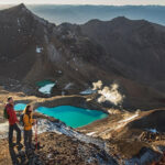
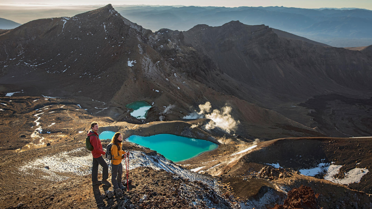
The next push is the steep climb to Red Crater, the highest point of the track at 1,886 meters above sea level. This is the most physically demanding section, and it’s also the most spectacular. The ground underfoot is a deep, rusty red, stained by oxidized iron in the rock. From the rim, the panorama is breathtaking and slightly intimidating. Directly below you, in a dark volcanic basin, lie the Emerald Lakes. These pools are an almost shockingly vivid jade green, a color caused by dissolved minerals that have leached from the surrounding thermal rock. Steam rises from the edges, and a sharp sulphur smell hangs in the air. The lakes are sacred and freezing cold, and swimming is not permitted.
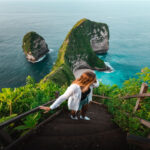
Past the Emerald Lakes, you descend past the Blue Lake, a larger and more peaceful crater lake that holds deep cultural significance. It is a sacred area to the local Māori, and you are asked to view it from a respectful distance without touching the water or descending to its shores. From here, the track begins its long, winding descent towards the Ketetahi car park, passing through golden tussock slopes, native beech forest, and eventually, the sight of Lake Taupō in the distance. The descent is hard on the knees but gentle on the soul, allowing you time to process the incredible drama of the volcanic terrain you have just walked through.
Why This Hike is Sacred The Māori Legend and Cultural Respect
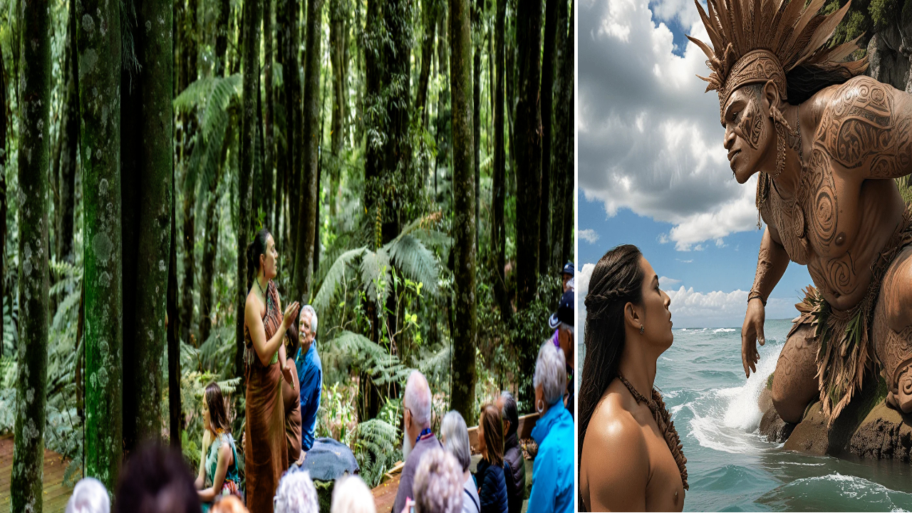
The Tongariro Hike New Zealand is not just a physical adventure; it is a journey through a deeply sacred cultural landscape. The peaks of Tongariro, Ngauruhoe, and Ruapehu are revered ancestors to the Ngāti Tūwharetoa iwi, the Māori guardians of this region. According to legend, the high priest Ngātoroirangi arrived from the mythical homeland of Hawaiki and climbed Tongariro to claim the land. Freezing in a southern blizzard, he called upon his sisters to send sacred fire. The fire traveled beneath the earth, bursting up at his feet to warm him, creating the volcanoes and thermal vents we see today.
In 1887, the paramount chief Horonuku Te Heuheu Tukino IV made a remarkable gift. Rather than let the sacred peaks be carved up and sold, he gifted the heart of the volcanic area to the Crown, on the absolute condition that it be protected as a national park for all people, for all time. This act created New Zealand’s first national park and one of the earliest gifts of its kind from an Indigenous people to a nation.
Understanding this history adds a profound layer to your hike. It’s not about ticking off a bucket list item. It’s about walking lightly and respectfully. Stay on the marked path at all times. Do not eat, drink, or linger at the sacred lakes. Do not touch or move stones. Do not fly drones, which are strictly prohibited. By honoring these simple rules, you show respect for the living culture that considers this landscape not a playground, but a treasured ancestor.
The Mountain Weather Why Preparation is Not Optional
New Zealand’s alpine weather is famously unpredictable. The Tongariro Alpine Crossing is an exposed, high-altitude environment with no shelter for the majority of the track. There is a saying on the mountain: you can experience four seasons in one day, and they may all be angry at you. The weather can shift from warm sunshine to freezing rain, gale-force winds, and thick, disorienting cloud within the space of twenty minutes. Even in the height of summer, temperatures at the Red Crater can drop close to freezing with wind chill.
The single most important piece of advice for anyone planning the Tongariro Hike is to check the official weather forecast from MetService and the Department of Conservation (DOC) before you set out. If the forecast is bad, do not go. The mountain is not going anywhere. Do not let your ego, your tight travel schedule, or the sunk cost of a shuttle booking push you into a dangerous situation. Every year, unprepared hikers have to be rescued, and tragically, some do not make it. Respect the mountain’s power.
The essential gear list is not a suggestion; it is a requirement. You need sturdy, worn-in hiking boots with good ankle support. You need a waterproof and windproof jacket and pants, not just a flimsy poncho. You need multiple warm layers, including a thermal base layer and a fleece or wool mid-layer, as well as a warm hat and gloves. Bring plenty of high-energy food like sandwiches, nuts, and chocolate, and at least two to three liters of water, as there is no drinkable water on the track. A head torch, a basic first-aid kit, sunscreen, and sunglasses are also non-negotiable. Your phone battery will drain faster in the cold, so a power bank is a smart addition. Do not rely on your phone for navigation; have a map or a downloaded offline trail map.
Practical Planning Shuttles, Toilets, and Timing
The Tongariro Alpine Crossing is a one-way track, which means you need to arrange transport to the start at Mangatepopo and from the finish at Ketetahi. Private cars are strongly discouraged because the car parks at both ends have strict four-hour time limits, which are completely unrealistic for the hike. A network of licensed shuttle operators runs from nearby towns like National Park Village, Whakapapa, and Turangi. You book a pickup time for the end of the hike, and if you miss it, you will be faced with a very expensive private taxi. It is crucial to choose a realistic pickup window, factoring in plenty of rest breaks, photo stops, and the fact that the descent is steep and often slow for tired knees.
There are toilet facilities at the start of the track and at the Ketetahi end, as well as a few long-drop toilets along the way. However, there are no toilets between the Mangatepopo Hut and the Ketetahi Hut, a distance of several hours. Pack your own toilet paper and a small sealable bag to carry out all waste, as you are required to pack out everything you pack in.
The best time to hike the Tongariro Alpine Crossing is during the Southern Hemisphere’s summer and early autumn, from November to April. During this period, the track is typically free of snow and ice, and the weather is more stable. Winter hiking, from May to October, is only suitable for experienced alpine trampers with crampons, ice axes, and the skills to use them. For everyone else, a guided winter tour with an accredited operator is the only safe option.
Frequently Asked Questions (FAQ) About the Tongariro Hike New Zealand
Q1: How fit do I need to be to complete the Tongariro Alpine Crossing?
You do not need to be an elite athlete, but you do need a solid base level of fitness. The track is 20.2 kilometers long with a total elevation gain of around 800 meters, and it takes six to eight hours on average. You should be comfortable walking for a full day over rough, uneven terrain. In the weeks leading up to your hike, practice by doing long walks with hills and stairs. If you have serious knee or ankle problems, the steep descent from Red Crater can be very painful, and walking poles are highly recommended.
Q2: Is there a best direction to walk the crossing?
Yes. The crossing is designed to be walked in one direction: from Mangatepopo to Ketetahi. Walking it in reverse is possible but not recommended for most people. The Mangatepopo end has a more gradual start, and climbing the Devil’s Staircase is safer and easier than descending it. The Ketetahi descent is long but steady, and doing it in reverse would mean a brutal, discouraging climb at the end of an already exhausting day. Also, the views unfold most spectacularly when walking in the recommended direction, building towards the Red Crater and Emerald Lakes reveal.
Q3: Can I hike the crossing on my own, or do I need a guide?
In summer, the track is well-marked and heavily trafficked, so thousands of independent hikers complete it safely on their own. You do not need a guide, but you do need to be self-sufficient and prepared. In winter, however, the track is covered in snow and ice, and the markers are often buried. An ice axe and crampons are essential, and the skills to use them are non-negotiable. Unless you have alpine mountaineering experience, a guided walk with a licensed operator is the only safe way to hike in winter.
Q4: Are there any age restrictions or limits for children?
There is no official age restriction, but the Tongariro Alpine Crossing is a very long, demanding day for young children. The Department of Conservation does not recommend it for children under the age of about ten, but it really depends on the individual child’s fitness, experience, and motivation. The volcanic terrain is harsh, the weather can be frightening, and there are steep drop-offs with no guardrails. If you bring a child, they must be closely supervised at all times, and you must be prepared to turn back if conditions deteriorate or they become too tired.
Q5: What happens if the weather turns bad halfway through the hike?
This is a critical question. The safest option in deteriorating weather is to turn back. Do not push on towards the high exposed section around Red Crater if visibility is dropping to nothing and the wind is becoming dangerous. The majority of serious incidents on the crossing happen when people ignore the warning signs. There is no shelter, no shortcut, and no rescue helicopter on standby for a quick lift. If you are already past the highest point and the weather turns, stay on the track, stay together as a group, layer up, and get down to Ketetahi as carefully and quickly as you safely can. Letting your shuttle driver know of any delays is also vital if you have cellphone reception.
Q6: Can I bring my drone to film the Emerald Lakes?
No. Drones are strictly and completely prohibited within Tongariro National Park. This rule is in place to protect the cultural sanctity of the site, to avoid disturbing other hikers seeking a wilderness experience, and to prevent accidents in an area with helicopter activity. You cannot legally fly a drone anywhere on the crossing without a special, rarely granted permit. Leave it at home, and simply soak in the view with your own eyes. You will remember it far better that way.