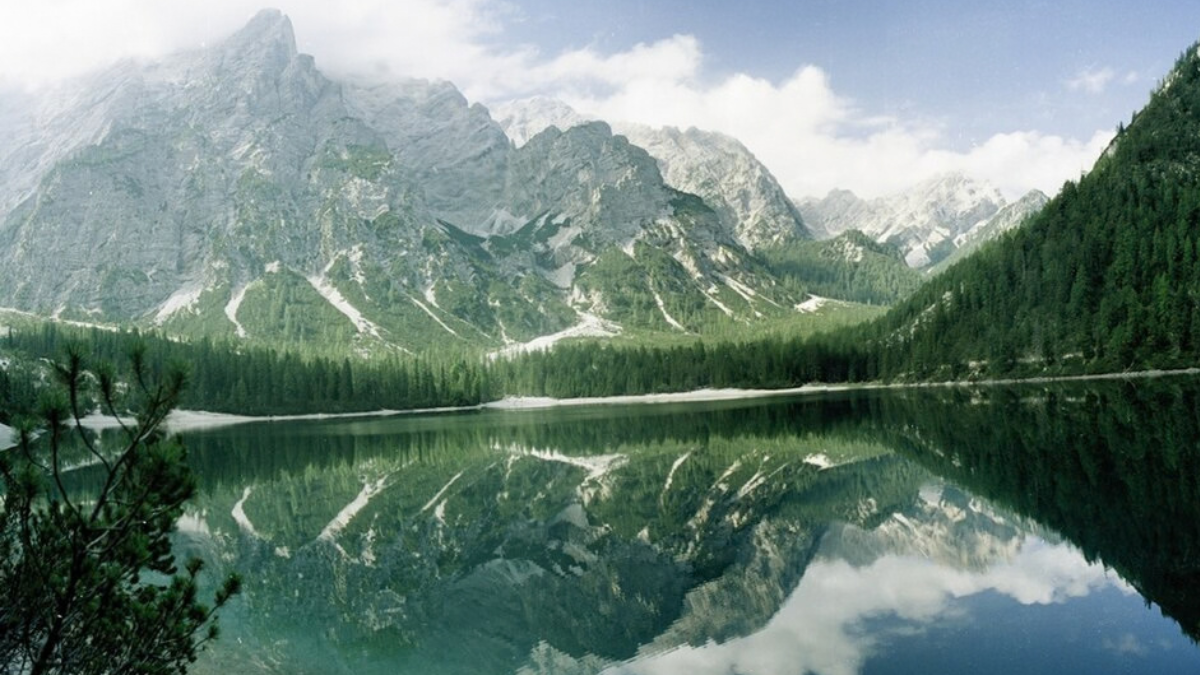
The Dolomites contain some of the most spectacular hiking landscapes in Europe. Trails cross high alpine meadows, circle enormous limestone towers, climb to mountain refuges and lead past turquoise lakes framed by some of the most recognizable peaks in northern Italy.
The best part is the variety. You do not need to be an expert mountaineer to enjoy the Dolomites. Some of the region’s most memorable walks take only a few hours, while experienced hikers can choose demanding full-day routes through high passes and remote nature parks.
This guide covers 15 of the best hikes in the Dolomites, ranging from the classic Tre Cime di Lavaredo circuit and the Seceda ridgeline to Lago di Sorapis, the Puez-Odle plateau, Sassolungo and quieter panoramic routes around South Tyrol and Cortina d’Ampezzo.
The numbering is designed to make the guide easy to browse rather than to claim that one trail is objectively better than every other hike. Distances and times refer to the route variants described below and may change slightly depending on lift use, trailhead, side trips and current trail conditions.


15 Best Hikes In The Dolomites At A Glance
| # | Hike | Distance | Time | Level | Area |
|---|---|---|---|---|---|
| 1 | Tre Cime di Lavaredo Loop | 8.8 km | ~4 hrs | Easy–Moderate | Tre Cime |
| 2 | Seceda Ridge | 1 km ridge / longer options | 1 hr+ | Easy–Hard | Val Gardena |
| 3 | Lago di Sorapis | 10.5 km | ~4 hrs | Challenging | Cortina |
| 4 | Adolf Munkel Trail | 12.4 km | ~3h 50m | Moderate | Val di Funes |
| 5 | Cinque Torri Loop | 4.7 km | ~2 hrs | Easy | Cortina |
| 6 | Puez-Odle Traverse | 15 km | ~4h 30m | Hard | Val Gardena |
| 7 | Sassolungo Circuit | 10.9 km | ~3h 30m | Moderate | Val Gardena |
| 8 | Lago di Braies Loop | ~3.5 km | ~1h 30m | Easy | Braies |
| 9 | Hans & Paula Steger Trail | 8.7 km | ~2h 10m | Moderate | Alpe di Siusi |
| 10 | Rifugio Nuvolau | 9.8 km | ~5 hrs | Hard | Passo Giau |
| 11 | Lagazuoi & Forcella Travenanzes | 4.7 km | ~2h 15m | Moderate | Lagazuoi |
| 12 | Croda da Lago & Lago Federa | Varies by route | Half / full day | Moderate–Hard | Cortina |
| 13 | Resciesa Panorama Hike | 5 km | ~1h 30m | Easy | Ortisei |
| 14 | Lago del Lagazuoi Loop | 8.9 km | ~3h 40m | Moderate | Lagazuoi |
| 15 | Sesto Three-Hut Hike | 17.9 km | ~6h 30m | Hard | Sesto |
1. Tre Cime di Lavaredo Loop
Distance: 8.8 km
Time: about 4 hours
Elevation change: about 550 m ascent and descent
Start: Rifugio Auronzo
Difficulty: Easy to moderate
If you only have time for one classic Dolomites hike, the circuit around Tre Cime di Lavaredo is one of the strongest choices.
The three enormous limestone towers rise almost vertically from the surrounding plateau and have become a symbol of the Dolomites.
The standard circuit begins at Rifugio Auronzo. Trail 101 leads past Rifugio Lavaredo and climbs gradually toward Forcella Lavaredo, where the famous northern faces begin to dominate the view.
The circuit continues toward Rifugio Locatelli / Drei Zinnen Hütte before looping around the western and southern side of the massif.
The trail is not technically difficult in normal summer conditions, but it is still high mountain terrain. Fog, thunderstorms or early-season snow can transform an easy-looking walk into a very different experience.
2. Seceda Ridge
Seceda is one of the most recognizable viewpoints in the Dolomites.
The grassy southern slope suddenly ends at an extraordinary wall of rock, with the jagged Odle/Geisler peaks appearing to rise directly from the ridgeline.
The summit area reaches approximately 2,519 meters.
The famous Seceda Ridge Line section itself is only around 1 kilometer and can be explored in roughly an hour with photo stops.
However, there are several ways to turn Seceda into a genuine hike.
Easy Option
Take the cable car from Ortisei to Seceda, walk along the ridgeline and continue through the alpine meadows toward nearby huts.
Hard Option
Hike all the way from Ortisei. Val Gardena’s official route is approximately 7.6 km to the ridge, requires about 1,261 meters of climbing and is rated difficult.
The full ascent usually takes a little over four hours before any additional ridge exploration.
A current trail detail worth knowing is that part of trail no. 6 east of the Seceda summit cross now uses a paid turnstile. The famous main ridge viewpoint can still be enjoyed without needing that extension.

3. Lago di Sorapis
Distance: 10.5 km
Time: about 4 hours
Elevation gain: about 434 m
Start: Passo Tre Croci
Difficulty: Challenging / exposed sections
Lago di Sorapis is famous for its unusual turquoise-blue water beneath the Sorapis mountain group.
The standard route begins at Passo Tre Croci and follows trail 215.
The first section moves through forest and relatively easy terrain, but later sections become more serious.
The official Cortina trail description notes several exposed ledges, metal ladders and sections protected by wire ropes.
For that reason, this should not be confused with a relaxed lake walk such as Lago di Braies.
Hikers uncomfortable with heights may find Sorapis difficult even if the total elevation gain appears modest.
Go early during peak summer because the lake and narrow trail sections can become busy.

4. Adolf Munkel Trail
Distance: about 12.4 km
Time: about 3 hours 50 minutes
Elevation gain: about 593 m
Area: Val di Funes / Villnöss
Difficulty: Moderate
The Adolf Munkel Trail passes directly beneath the enormous north faces of the Odle/Geisler mountains.
Unlike Seceda, where you look across toward the peaks, this trail brings you to the meadows and forest immediately below the rock walls.
The standard route begins around Zans and follows trail numbers 6 and 35 toward the alpine pastures.
The scenery alternates between forest, open meadows and mountain huts where hikers can stop for food.
A shorter circular variation of approximately 9 km and 3 hours is also possible from Zans.
This is one of the best hikes for people who want classic Dolomite mountain scenery without spending the entire day on an exposed high-altitude trail.
5. Cinque Torri Loop
Distance: 4.7 km
Time: about 2 hours
Elevation gain: about 67 m on the lift-assisted version
Difficulty: Easy
Cinque Torri — the Five Towers — combines dramatic rock scenery with First World War history.
The easiest version begins by taking the chairlift from Bai de Dones to Rifugio Scoiattoli.
From there, trails weave directly among the rock towers and through the preserved trenches of the open-air Great War museum.
The formations are also extremely popular with rock climbers, so it is common to see climbers high above the hiking trail.
Continue toward Rifugio Cinque Torri before descending through forest toward Lago di Bai de Dones.
Because the lift removes most of the climbing, this is one of the best choices for families and travelers looking for a short but highly scenic Dolomites experience.


6. Puez-Odle Traverse
Distance: 15 km
Time: about 4 hours 30 minutes
Ascent: about 500 m
Descent: about 900 m
Difficulty: Hard
The Puez-Odle Nature Park offers a very different side of the Dolomites.
Instead of only green meadows and sharp towers, parts of Puez have an almost lunar landscape of pale limestone plateaus, high passes and exposed rock.
One excellent route begins from the Dantercepies gondola above Selva di Val Gardena.
The trail climbs toward Passo Cir, crosses toward Passo Crespëina and passes Lago di Crespëina before reaching Rifugio Puez.
From Puez, the route descends through the long Vallunga valley toward Selva.
Because this is a point-to-point route with considerable time above 2,000 meters, good weather is important.
This is one of the strongest full-day choices for experienced hikers staying in Val Gardena.
7. Sassolungo Circuit
Distance: 10.9 km
Time: about 3 hours 30 minutes
Ascent: about 350 m
Difficulty: Moderate
The Sassolungo massif dominates the skyline between Val Gardena and Passo Sella.
A classic circuit allows hikers to experience several sides of this enormous mountain group rather than viewing it from only one valley.
The official route can use the Mont de Sëura chairlift and the traditional gondola toward Forcella Sassolungo.
Trails then descend between giant rock walls and pass mountain huts before returning through forest and alpine terrain.
Some sections cross scree and steeper mountain ground, so surefootedness is useful.
Early in the summer season, snow can remain around the higher sections.

8. Lago di Braies Loop
Distance: approximately 3.5 km
Time: approximately 1.5 hours
Difficulty: Easy
Lago di Braies, or Pragser Wildsee, is one of the most photographed lakes in the Dolomites.
A path circles the entire lake beneath Croda del Becco / Seekofel.
The route is relatively easy compared with most hikes in this guide, although parts of the path are narrower and rougher than the broad lakeside section near the hotel and boathouse.
The lake sits inside the Fanes-Sennes-Braies Nature Park and is also the traditional starting point of the famous Alta Via 1 long-distance trek.
Come early if possible. This is one of the busiest attractions in the Dolomites during peak summer.

9. Hans & Paula Steger Trail, Alpe di Siusi
Distance: 8.7 km
Time: about 2 hours 10 minutes
Elevation gain: about 301 m
Difficulty: Moderate
Alpe di Siusi / Seiser Alm is one of the largest high alpine meadows in Europe and offers some of the gentlest scenic hiking in the Dolomites.
The Hans and Paula Steger Trail runs between Compatsch and Saltria.
The route crosses broad meadows and sections of forest with views toward Sassolungo and Sassopiatto.
This is a strong choice for hikers who care more about alpine scenery than reaching a dramatic summit.
It is also much less exposed than Sorapis, Nuvolau or the high Puez routes.
Access to Alpe di Siusi is regulated. The road into the protected plateau is closed to ordinary private traffic during much of the daytime, so most visitors use the cable car or public transport.
10. Rifugio Nuvolau From Passo Giau
Distance: 9.8 km
Time: about 5 hours
Elevation gain: about 612 m
Highest point: around 2,575 m
Difficulty: Hard
Passo Giau is already one of the most impressive roadside viewpoints in the Dolomites, but hiking from the pass makes the area even better.
The official route toward Rifugio Nuvolau crosses open mountain terrain with views of Ra Gusela, Croda da Lago, Lastoi de Formin and Cinque Torri.
The trail eventually reaches the Cinque Torri area and continues toward Rifugio Averau and then Nuvolau.
Rifugio Nuvolau sits in an extraordinary position high above the surrounding valleys.
The combination of distance, climbing and high mountain terrain makes this significantly more demanding than the short Cinque Torri loop.
11. Lagazuoi & Forcella Travenanzes
Distance: about 4.7 km
Time: approximately 2 hours 15 minutes
Difficulty: Moderate
Lagazuoi combines spectacular high mountain views with some of the most visible First World War history in the Dolomites.
Trails cross the former frontline and reveal trenches, military positions and tunnels built into the mountain.
A moderate hiking route connects the Lagazuoi area with Forcella Travenanzes.
There are also separate equipped routes through the Lagazuoi tunnels and the Kaiserjäger trail.
12. Croda da Lago & Lago Federa
Lago Federa is one of the most beautiful mountain lakes around Cortina d’Ampezzo.
The lake sits beneath the Croda da Lago massif at roughly 2,000 meters and is surrounded by larch forest, mountain walls and the distinctive Becco di Mezzodì.
There are several ways to reach Lago Federa, which is why the exact distance depends on your chosen starting point.
Longer routes can continue through Forcella Ambrizzola and around Croda da Lago, creating a demanding full-day circuit.
Shorter approaches focus mainly on Rifugio Croda da Lago and Lago Federa.
Autumn is particularly beautiful here when the larches turn golden, although hikers must check hut closures and early snow conditions later in the season.

13. Resciesa Panorama Hike
Distance: 5 km
Time: about 1 hour 30 minutes
Elevation gain: around 197 m
Difficulty: Easy
Resciesa / Rasciesa is one of the best alternatives when you want a panoramic Val Gardena hike without the crowds or climbing of Seceda.
A funicular from Ortisei takes visitors high above the valley.
From the upper station, a relatively easy trail crosses the plateau toward viewpoints over Val Gardena and the surrounding Dolomite groups.
The official 5 km route gains less than 200 meters and is suitable for many families with hiking experience.
Because the trail stays around 2,100–2,280 meters, weather can still change rapidly even though the hike itself is straightforward.
14. Lago del Lagazuoi Loop
Distance: 8.9 km
Time: about 3 hours 40 minutes
Difficulty: Moderate
High point: about 2,750 m
Travelers often visit Lagazuoi only for the cable-car viewpoint or war tunnels, but the hike to Lago del Lagazuoi gives the area a completely different character.
The route crosses high alpine terrain below enormous rock faces and descends toward the small mountain lake.
Because the trail reaches well above 2,500 meters, early-season snow and sudden weather changes matter more here than on lower valley walks.
This is a strong choice if you want a proper half-day mountain hike but do not want the exposure of Sorapis or a full Puez traverse.
15. Sesto Three-Hut Hike
Distance: 17.9 km
Time: about 6 hours 30 minutes
Elevation gain: approximately 1,233 m
Difficulty: Hard
The Three-Hut Hike in the Sesto / Sexten area is one of the more demanding trails on this list.
It combines several mountain refuges with big views across the Sesto Dolomites and the Tre Cime region.
Unlike the standard Tre Cime loop, this route earns its views through substantial climbing.
With almost 18 kilometers of hiking and more than 1,200 meters of ascent, good fitness and stable weather are important.
This is a better choice for experienced hikers looking for a full mountain day than for travelers simply looking for a short scenic walk.
Map Of The Best Dolomites Hikes
The hikes in this guide are spread across several different Dolomite regions. They should not be treated as if they all begin near the same town.
Where To Stay For Dolomites Hiking
There is no single perfect base for all 15 hikes because the Dolomites cover a large area.
| Base | Best Nearby Hikes |
|---|---|
| Cortina d’Ampezzo | Sorapis, Cinque Torri, Nuvolau, Lagazuoi, Croda da Lago |
| Ortisei | Seceda, Resciesa, Alpe di Siusi |
| Selva di Val Gardena | Puez-Odle, Sassolungo, Passo Gardena |
| Val di Funes | Adolf Munkel Trail |
| Dobbiaco / Toblach | Tre Cime, Lago di Braies |
| Sesto / Sexten | Tre Cime region, Three-Hut Hike |
| Siusi / Castelrotto | Alpe di Siusi |
Best Dolomites Hikes For Beginners
If this is your first mountain-hiking trip, start with trails that offer dramatic scenery without long exposure or complicated terrain.
- Lago di Braies Loop — easy and relatively short.
- Cinque Torri Loop — lift-assisted and packed with scenery.
- Resciesa — panoramic without a major climb.
- Hans & Paula Steger Trail — rolling alpine meadows.
- Tre Cime Loop — longer but straightforward in normal summer conditions.
- Seceda Ridge — easy if you use the cable car.
Best Hikes For Experienced Hikers
- Puez-Odle Traverse
- Sesto Three-Hut Hike
- Rifugio Nuvolau from Passo Giau
- Long Croda da Lago circuit
- Full Seceda ascent from Ortisei
- Lago di Sorapis for hikers comfortable with exposure
Best Hikes Without A Car
The Dolomites are easier without a car than many travelers expect, particularly in Val Gardena and South Tyrol.
Seceda, Resciesa and Alpe di Siusi can all be reached using lifts and public transportation from valley towns.
The Adolf Munkel Trail can be reached by bus to Zans, while the Tre Cime region also operates seasonal public transportation.
Cortina’s trailheads are more spread out, but local buses and seasonal lift systems make some hikes possible without driving.
Dolomites Cable Cars & Lifts
Cable cars are not only sightseeing attractions in the Dolomites. They are an important part of the hiking network and can remove hundreds or even more than 1,000 meters of climbing.
For the 2026 summer season, examples included:
- Ortisei–Furnes and Furnes–Seceda: scheduled from 22 May to 2 November 2026.
- Forcella Sassolungo gondola: scheduled from 30 May to 11 October 2026.
- Lagazuoi cable car: 30 May to 18 October 2026.
- Cinque Torri chairlift: 6 June to 11 October 2026.
- Fedare chairlift at Passo Giau: 11 July to 15 September 2026.
Opening dates are weather-dependent and change every year. Never design a one-way hike around a lift without confirming its final downhill departure time.
Best Time To Hike In The Dolomites
June
Lower trails and meadows can be excellent, but high passes may still hold snow after a snowy winter.
July & August
This is the main hiking season. Most lifts, mountain huts and high trails are operating, but famous locations can become extremely busy.
September
One of the strongest months for hiking. Crowds usually begin to fall, while many lifts and huts remain open for much of the month.
Days become shorter and cold mornings become more common.
October
Autumn colors can be spectacular, particularly around Lago Federa, but services begin closing and early snowfall is possible.
Some lifts continue into October or early November, while others close much earlier.
Dolomites Weather & Thunderstorms
Do not judge mountain weather only by conditions in the valley when you wake up.
High Dolomite ridges can experience:
- rapid cloud build-up;
- heavy rain;
- hail;
- strong wind;
- lightning;
- sudden temperature drops;
- summer snow at high elevation.
On long exposed hikes, starting early gives you more time before afternoon weather becomes a problem.
If thunderstorms are forecast, an exposed high ridge is not the place to wait and see what happens.
What To Pack For Dolomites Hiking
- Hiking shoes or boots with reliable grip
- Lightweight waterproof jacket
- Warm mid-layer
- Water
- Snacks or lunch
- Sun hat
- Sunscreen
- Sunglasses
- Offline trail map
- Charged phone
- Power bank
- Small first-aid kit
- Emergency layer
- Cash for smaller mountain huts
- Trekking poles if useful on steep descents
Do You Need A Hiking Guide?
For normal marked hiking routes such as Tre Cime, Lago di Braies or Cinque Torri, experienced independent hikers generally do not need a mountain guide in good summer conditions.
A guide becomes much more valuable when:
- you want to attempt a via ferrata;
- snow remains on high trails;
- you are uncomfortable with exposed terrain;
- you want a difficult summit route;
- you have limited navigation experience;
- you are hiking outside the main summer season.
Do not confuse a marked hiking trail with a via ferrata. Via ferratas can require a helmet, harness, shock-absorbing lanyard and the knowledge to use them correctly.
Mountain Huts In The Dolomites
One of the pleasures of hiking in the Dolomites is the network of mountain refuges, known in Italian as rifugi.
Many serve hot meals, drinks and desserts, while larger huts may also offer overnight accommodation.
Examples along routes in this guide include:
- Rifugio Locatelli
- Rifugio Auronzo
- Rifugio Lavaredo
- Rifugio Puez
- Rifugio Scoiattoli
- Rifugio Cinque Torri
- Rifugio Averau
- Rifugio Nuvolau
- Rifugio Croda da Lago
- Rifugio Lagazuoi
Do not depend on a hut for food or water without confirming that it is open. Opening periods depend on season, weather and individual management.
How Many Days Do You Need In The Dolomites?
3 Days
Choose one region rather than trying to drive across the entire Dolomites.
For example, stay in Cortina and hike Sorapis, Cinque Torri and one Lagazuoi route.
5 Days
You can combine two regions, such as Cortina plus Val Gardena.
7–10 Days
This gives enough time to combine Tre Cime, Cortina, Val Gardena, Val di Funes and Alpe di Siusi without spending every day rushing between trailheads.
Suggested 7-Day Dolomites Hiking Itinerary
Day 1: Lago di Braies + transfer toward Dobbiaco.
Day 2: Tre Cime di Lavaredo circuit.
Day 3: Transfer to Cortina + Cinque Torri.
Day 4: Lago di Sorapis or Croda da Lago.
Day 5: Transfer to Val Gardena + Seceda.
Day 6: Puez-Odle or Sassolungo circuit.
Day 7: Alpe di Siusi or Resciesa for an easier final hiking day.
Frequently Asked Questions
What is the most famous hike in the Dolomites?
The Tre Cime di Lavaredo circuit is probably the most internationally recognized hiking route in the Dolomites.
What is the best hike near Cortina?
Lago di Sorapis, Cinque Torri, Croda da Lago, Lagazuoi and Nuvolau are all excellent choices. The better option depends on your fitness and comfort with exposed trails.
Is Seceda an easy hike?
It can be. Taking the cable car almost to the ridge makes Seceda very accessible. Hiking all the way from Ortisei is a strenuous climb with more than 1,200 meters of elevation gain.
Is Lago di Sorapis suitable for beginners?
It is not the strongest first hike for anyone uncomfortable with heights. The official route includes exposed sections, metal ladders and fixed cables.
What is an easy Dolomites hike?
Lago di Braies, the lift-assisted Cinque Torri circuit and Resciesa are among the easier options in this guide.
Can I hike the Dolomites without a car?
Yes. Val Gardena, Alpe di Siusi, Val di Funes and the Tre Cime region have useful public-transport and cable-car networks. A car provides more flexibility around some Cortina trailheads.
When is the best month for Dolomites hiking?
July through September generally provides the most reliable access to high trails and mountain huts. September can be particularly attractive because temperatures are cooler and peak-summer crowds begin to decrease.
Can you hike the Dolomites in October?
Yes, depending on weather and elevation. However, some cable cars and mountain huts close during September or October, and early snowfall becomes increasingly possible.
Do I need hiking boots?
Sturdy hiking footwear with good grip is recommended for most mountain trails. Easy lakeside routes may require less technical footwear, but weather can still make paths slippery.
Are Dolomites hikes free?
Most hiking trails themselves do not require an entrance ticket, but parking, buses, toll roads, cable cars and chairlifts can add significant costs to a hiking day.
Final Thoughts
The Dolomites offer an unusual amount of variety within a relatively compact mountain region.
Tre Cime gives you the classic limestone towers, Seceda combines alpine meadows with a dramatic ridgeline, Sorapis leads to an almost unreal turquoise lake, and Puez-Odle feels remote and rugged despite being close to popular valley towns.
First-time visitors do not need to choose only the hardest trails. Cinque Torri, Lago di Braies, Resciesa and lift-assisted Seceda can deliver outstanding scenery with much less effort.
Experienced hikers can gradually move toward Puez, Nuvolau, Croda da Lago and the longer Sesto routes.
The biggest mistake is trying to fit every famous hike into a few days. Choose one or two bases, leave room for bad-weather days and spend enough time on each trail to actually enjoy the landscape rather than simply collecting viewpoints.
Sources
Drei Zinnen — Tre Cime Hiking & Route Information
Official regional information for the Tre Cime circuit and other hikes in the Sesto Dolomites.
Official hiking, ridge, lift and access information for Seceda.
Cortina Dolomiti — Lago Sorapis
Official route distance, time, elevation and exposed-section information.
South Tyrol — Adolf Munkel Trail
Cortina Dolomiti — Cinque Torri Loop
Val Gardena — Puez & Its Lunar Landscape
Val Gardena — Sassolungo Circuit
South Tyrol — Hans & Paula Steger Trail
Cortina Dolomiti — Rifugio Nuvolau
Cortina Dolomiti — Lagazuoi Hiking
Val Gardena — Current Lift Status & 2026 Schedules
Cortina d’Ampezzo — Summer 2026 Lift Openings
Information checked: September 2026. Trail status, lift schedules, hut openings, parking arrangements and mountain conditions can change. Confirm current conditions with the relevant local tourism office or lift operator before starting.